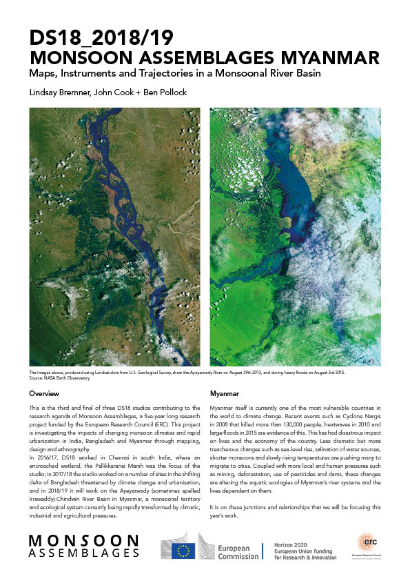
MYANMAR: COSMOPOLITICAL DESIGN IN A MONSOONAL RIVER BASIN
The third and final Monsoon Assemblages studio began at the end of September 2018, when 20 students registered for Design Studio 18 (DS18) in the M. Arch programme at the University of Westminster. They embarked on a year long studio on the Ayeyarwady-Chindwin River Basin in Myanmar, framed by the idea of cosmopolitical design. The studio was taught by Lindsay Bremner, John Cook and Ben Pollock.
STUDIO INTRODUCTION: DS18_2018_Intro
Brief 1: MAPPING THE AYEYARWADY-CHINDWIN RIVER BASIN
Central to first substantive brief of the year was the idea that a river is not a body of water flowing between two banks, but a complex, dynamic system, that extends across its entire basin, beneath the earth, on the surface and into the atmosphere, that changes over time, across seasons and in response to numerous pressures – a river is this entire spatio-temporal system. Student were required to select a theme through which to map the river as a dynamic entity, such as climate, geology, plant life, animal life etc. Their maps were required to include some element of time (e.g. seasonal cycles, deep time, future time etc.) and to represent the river in at least three dimensions. At the same time as drawing these thematic maps, they were required to map the river from the perspective of a particular non-human entity, such as a plant or tree species, an earth mineral, a fish species etc. which would be the basis for the rest of the year’s work.
Raymonde Bieler (MArch 2) mapped sediment, its distribution in Myanmar and its impact on the shape and path of the Ayeyarwady River and its banks.
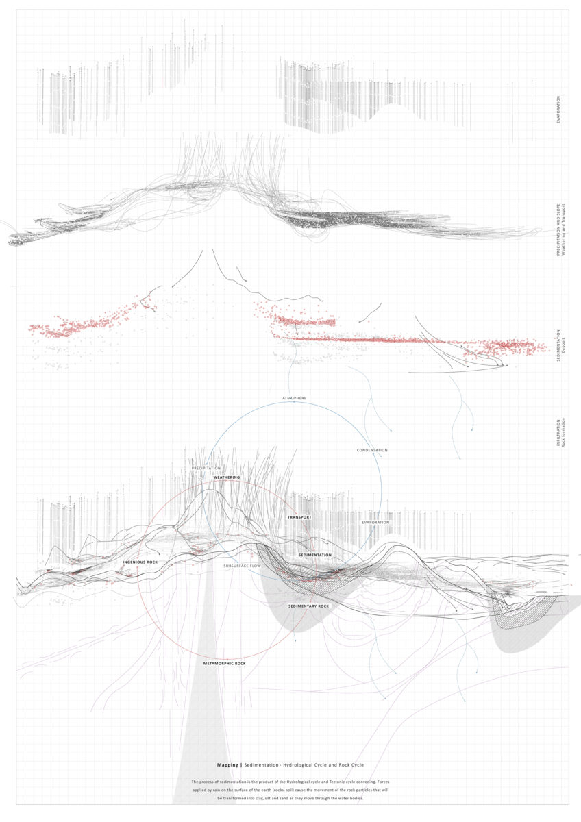
Sediment: The Hydrological and Rock Cycles. Raymonde Bieler (MArch 2), 2018.
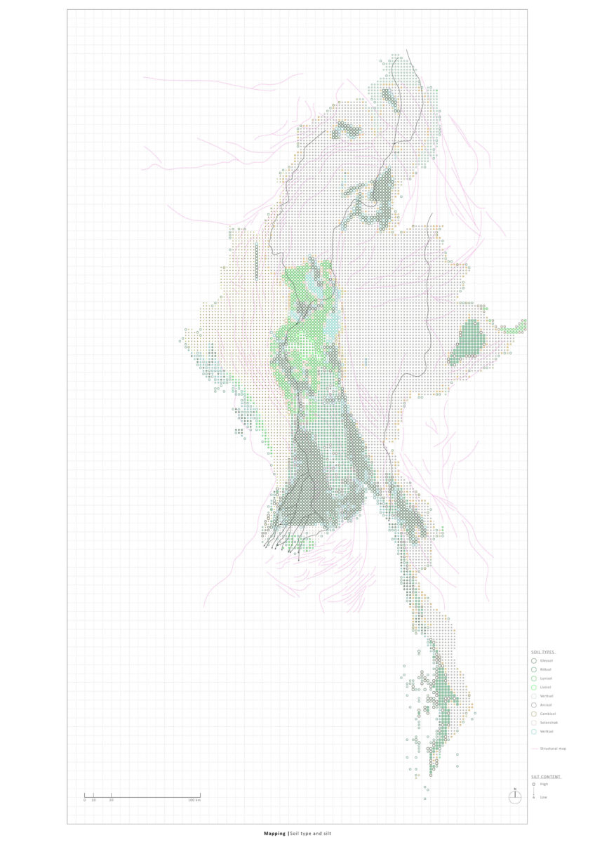
Soil Types in Myanmar. Raymonde Bieler (MArch 2), 2018.
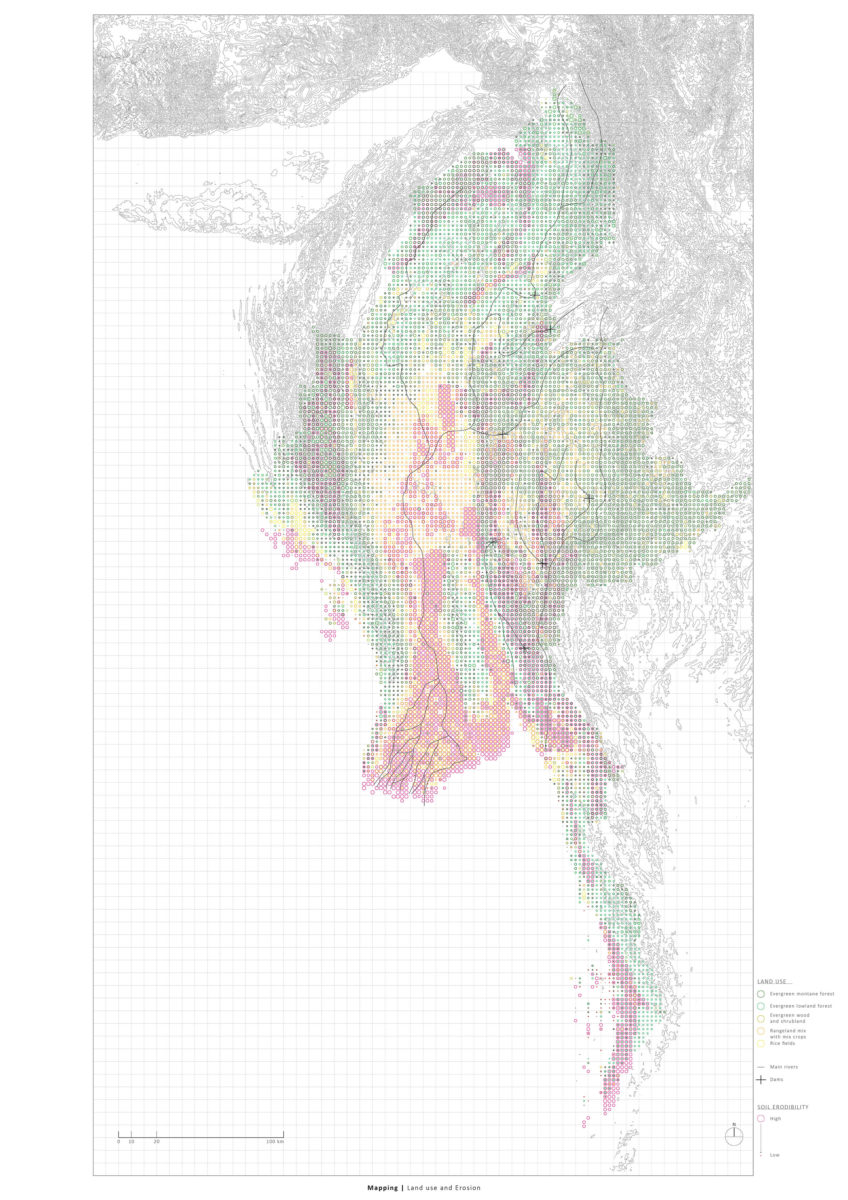
Land Use and Erosion in Myanmar. Raymonde Bieler (MArch 2), 2018.
Fiona Grieve (MArch 2) began with mapping global and Myanmar oil and gas deposits, which then developed into a mapping of the Shwe Gas an Oil Pipeline built by China from the Bay of Bengal across Myanmar to Kunming in Western China.
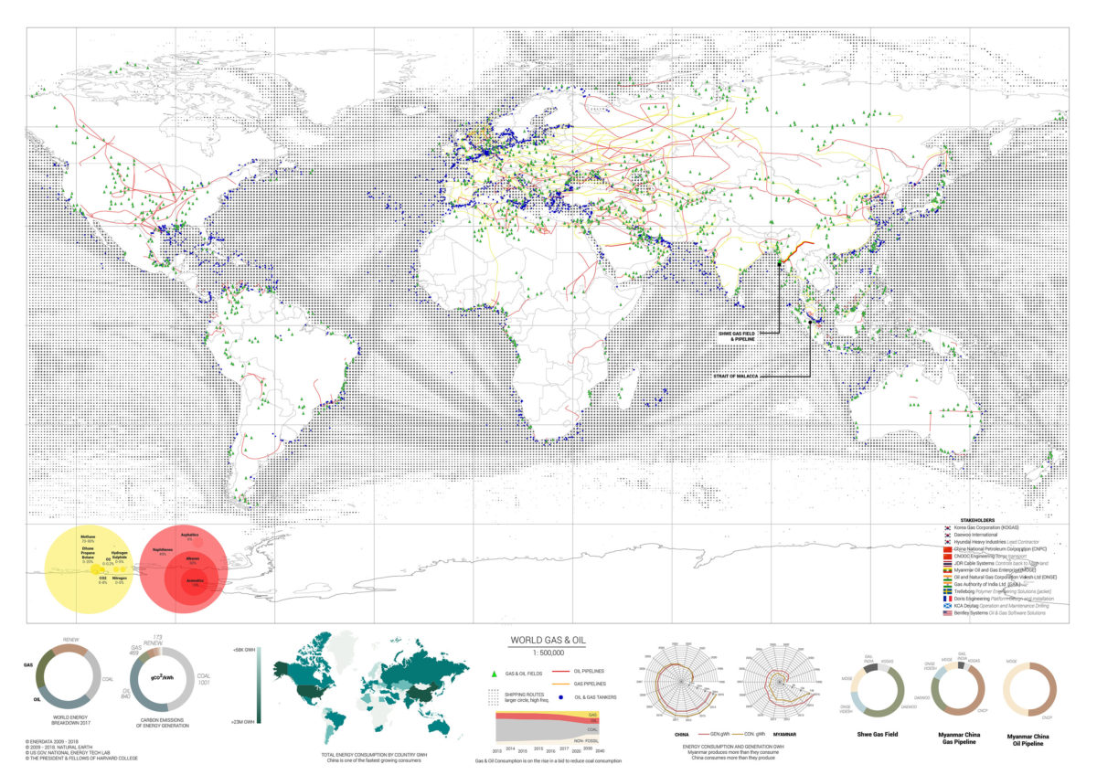
World Gas and Oil. Fiona Grieve (MArch 2), 2018.
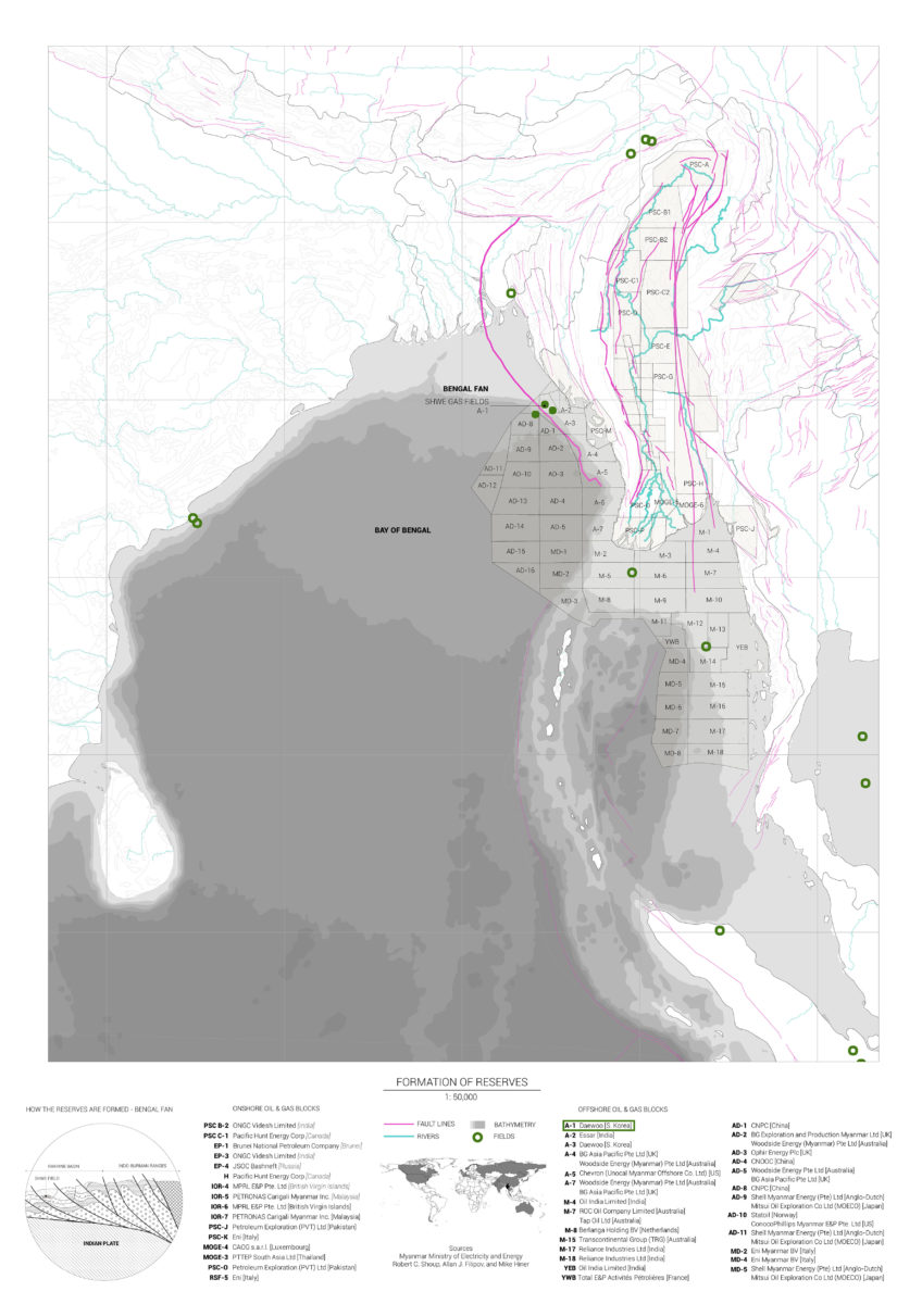
Fault Lines and Gas and Oil Reserves, Myanmar. Fiona Grieve (MArch 2), 2018.
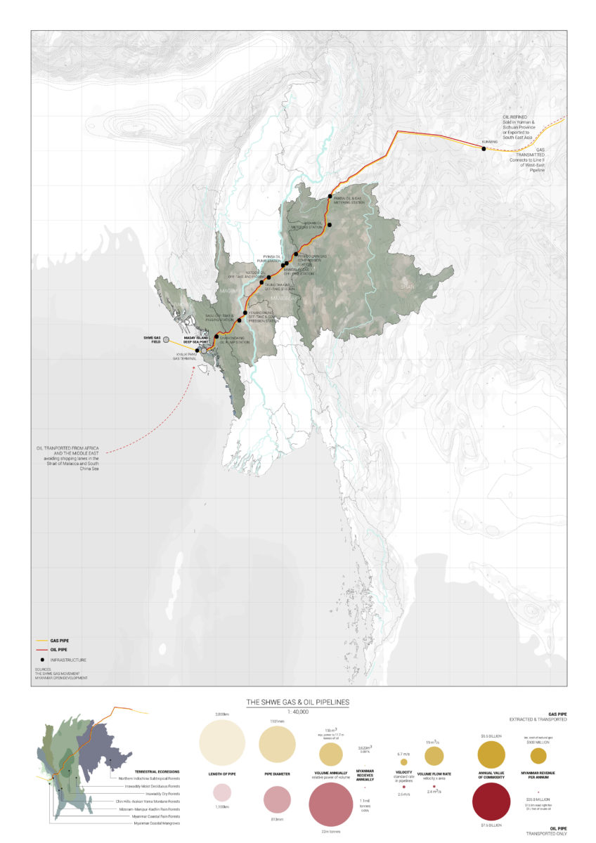
The Shwe Gas and Oil Pipeline. Fiona Grieve (MArch 2), 2018.
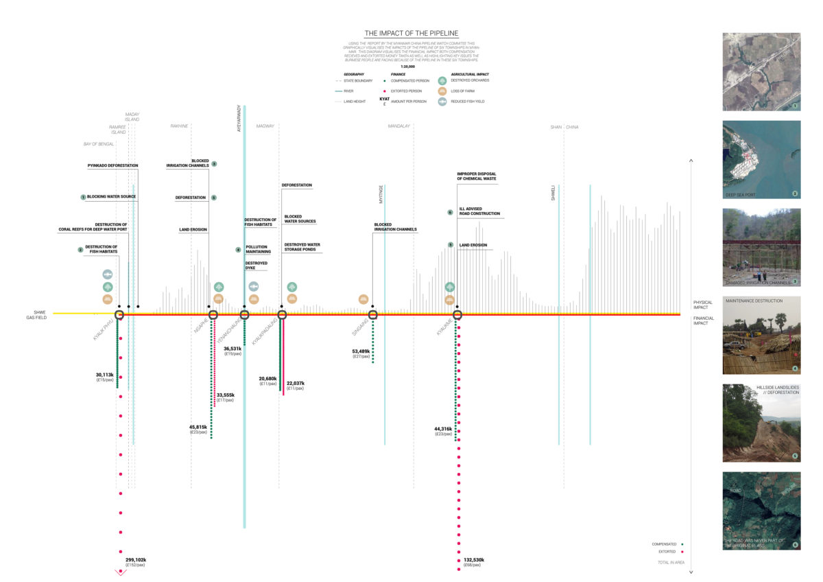
Conflict along the Shwe Gas and Oil Pipeline. Fiona Grieve (MArch 2), 2018.
Katie Dechow (MArch 1) studied and mapped the global food industry and its contribution to climate change. She then focused on rice cultivation and levels of methane production, in particular in Myanmar.
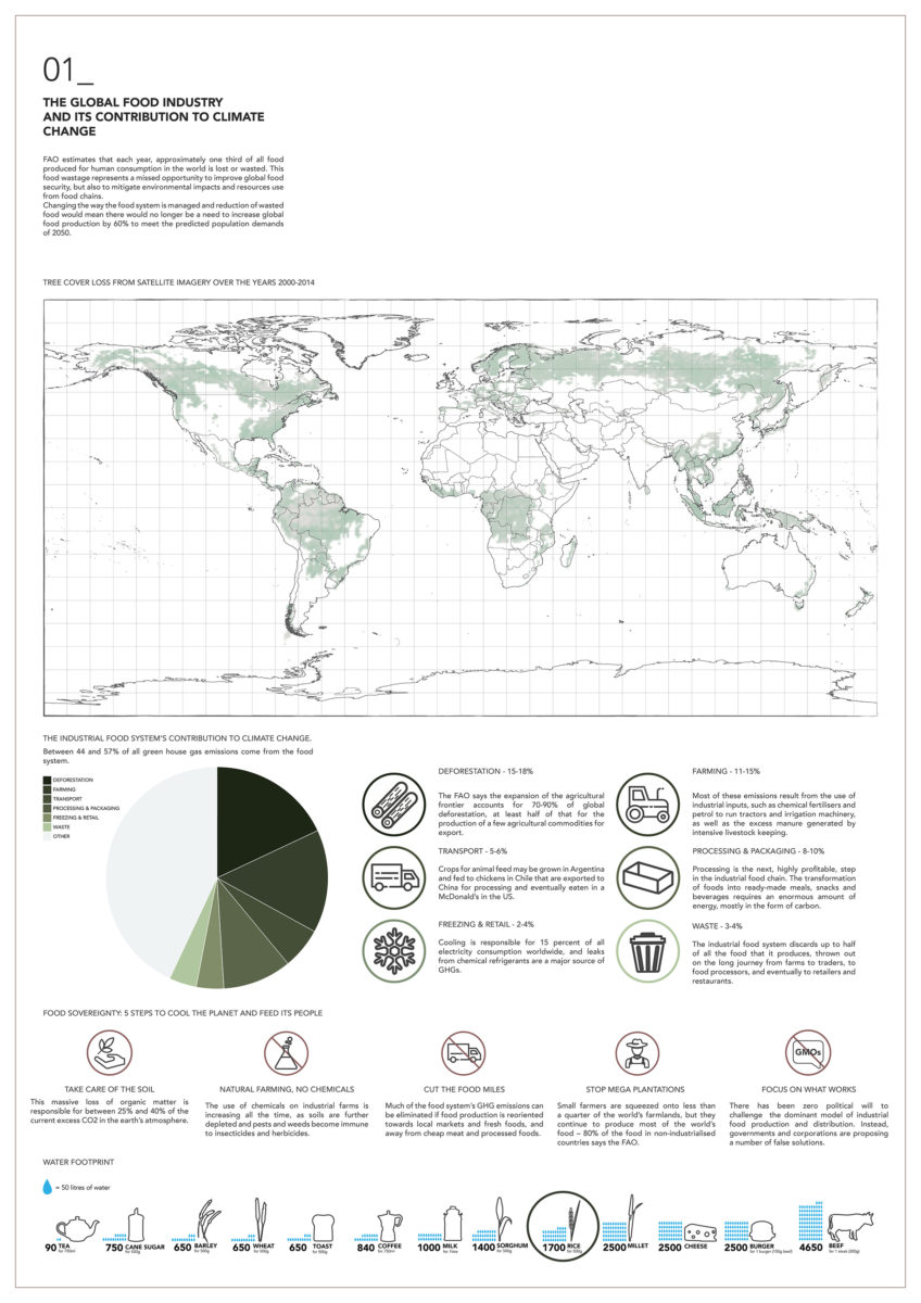
The Global Food Industry and its Contribution to Climate Change. Katie Dechow (MArch 1), 2018.
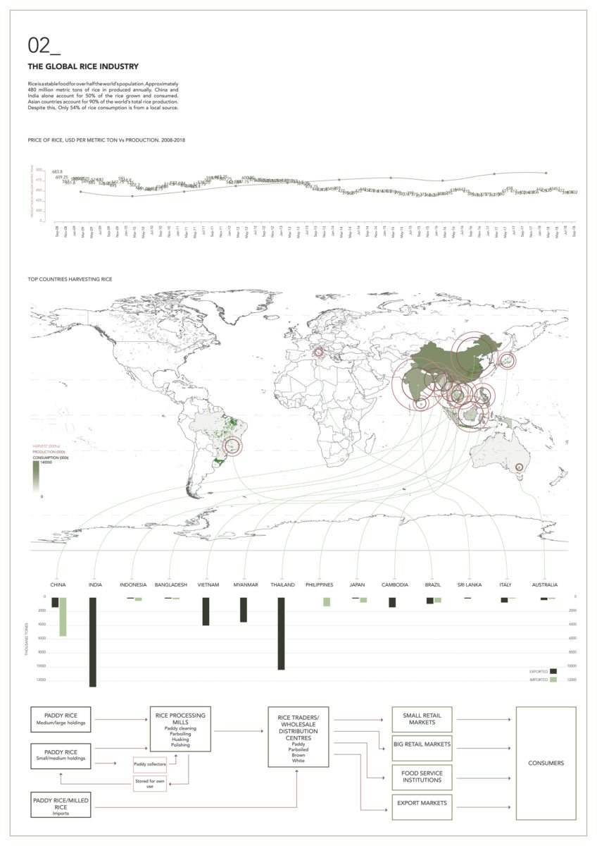
The Global Rice Industry. Katie Dechow (MArch 1), 2018.
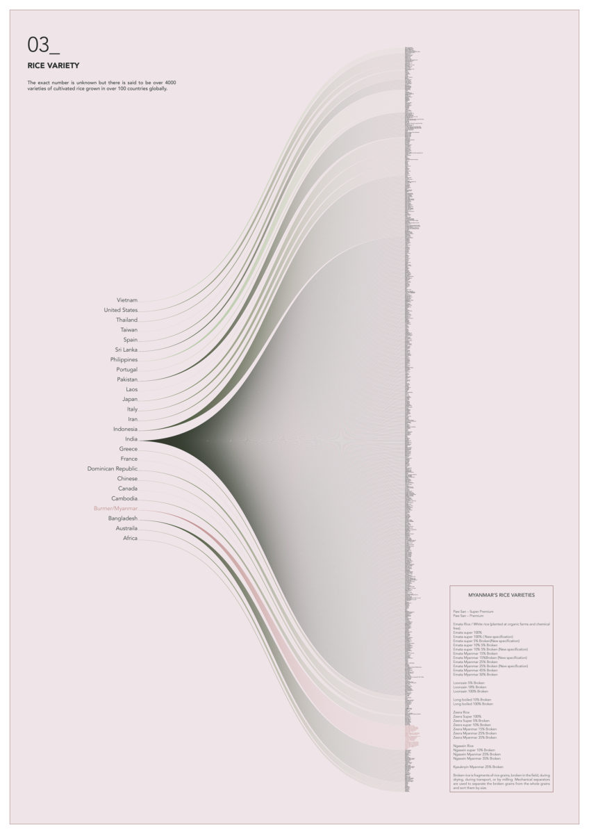
Rice Varieties. Katie Dechow (MArch 1), 2018.
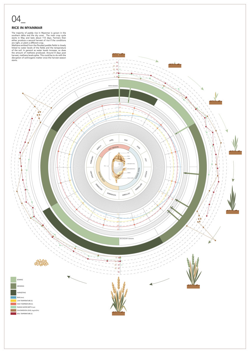
The Rice Calendar, Myanmar. Katie Dechow (MArch 1), 2018.
Temanna Akhter (MArch 1) mapped shrimp cultivation in Myanmar.
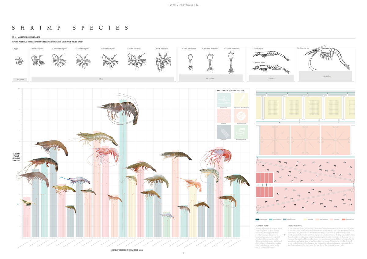
Shrimp Species in Myanmar. Tamanna Akhter (MArch 1), 2018.
Brief 2: SIMULATING A RIVERINE PROCESS
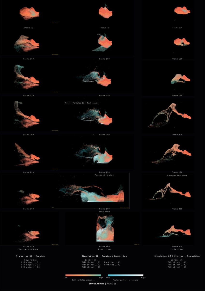
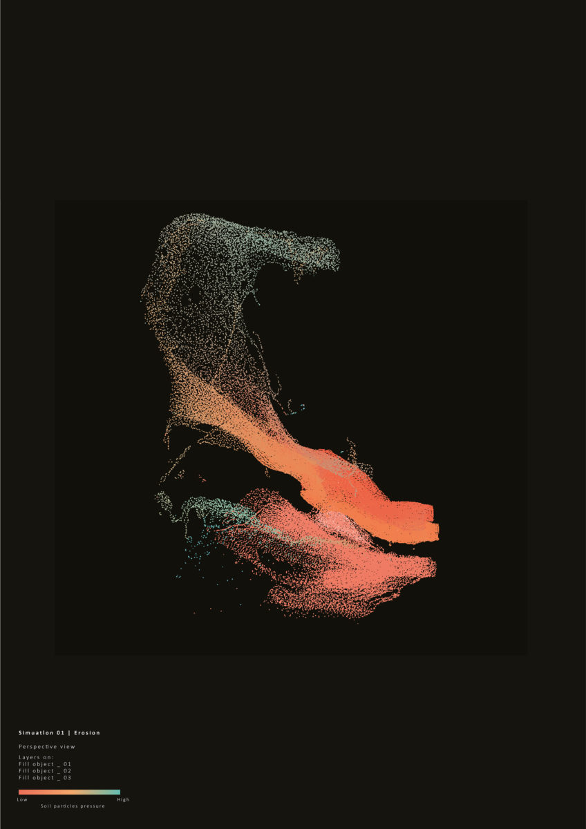
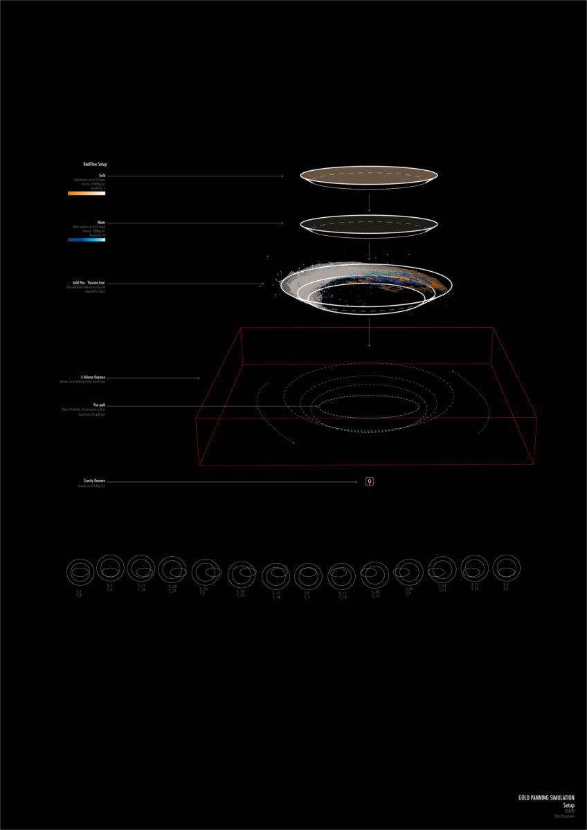
The second brief of the year required students to simulate a riverine process encountered by their entity. This was to enable them to visualise, model and study the river as a dynamic system, developing a spatial and temporal sensibility and intuition towards material dynamics. In keeping with previous years, this used software packages RealFlow, Rhino and Grasshopper.
Raymonde Bieler (MArch 2) simulated sediment deposition.
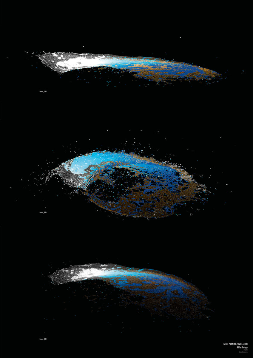
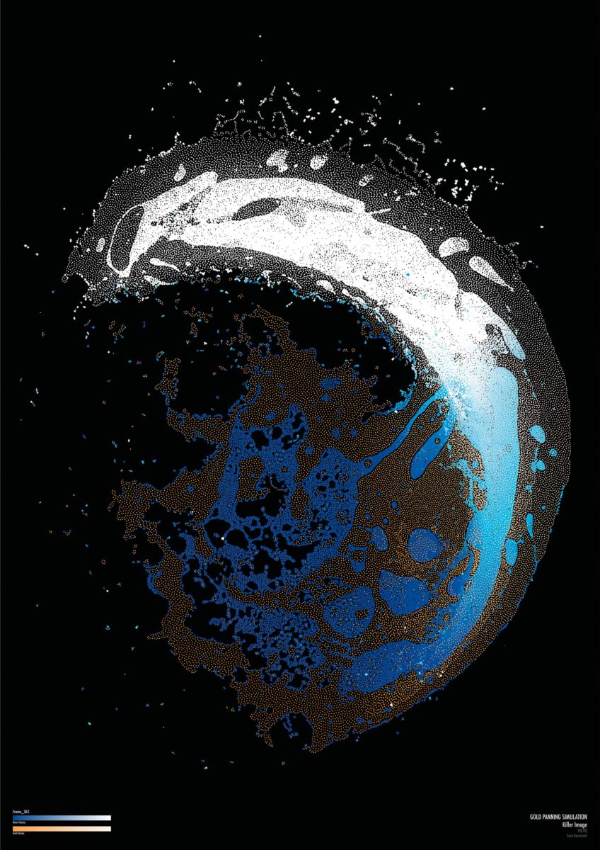
Sarak Kosnovic (MArch 1) simulated gold panning.

Brief 3: FIELD TRIP
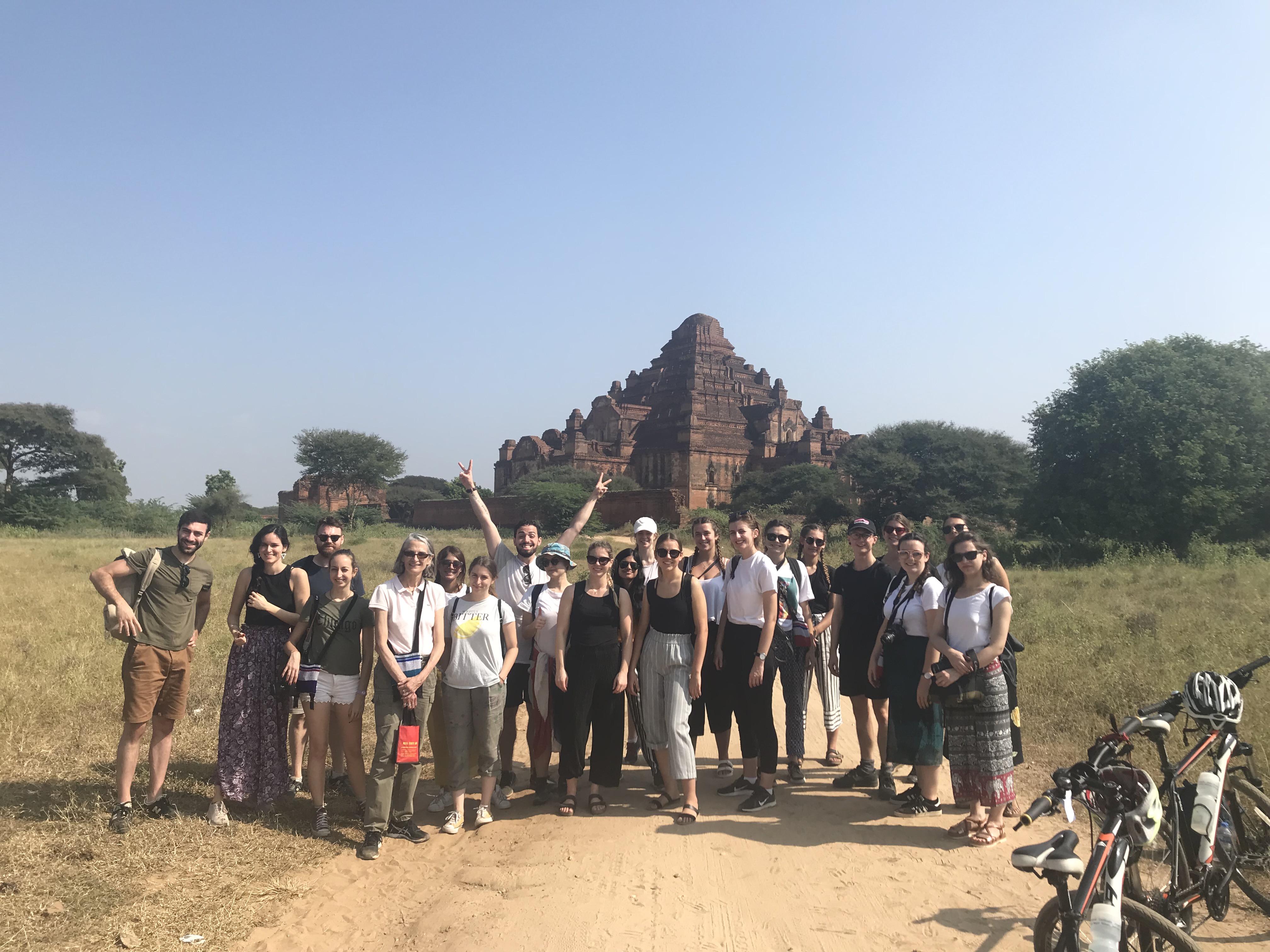
The studio went on a field trip to Myanmar from 01-13 November 2018, visiting Yangon, Twante, Bagan and Mandalay. As well as general exposure to the country, students gathered and/or map experiential and other data related to their non-human entity while there. This involved, for some, meeting with and talking to Burmese experts, or, for others, organising visits to sites particular to their entity and so on. Each students produced a booklet of their experiences and the information they gathered.
Brief 4: AUGMENTED SENSORIA
The aim of the final brief of semester 1 was the design and prototyping of an instrument to make an imperceptible / invisible change to some aspect of the Ayeryarwady-Chindwin River Basin, owing to climatic, political, economic, or socio-cultural pressures, perceptible to humans.
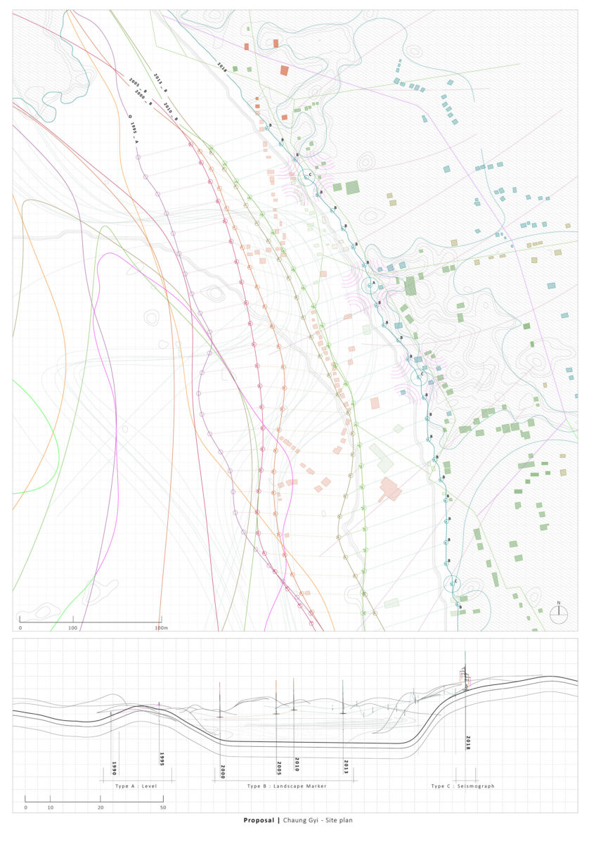
In response to this brief, Raymonde Bieler (MArch 2) designed an instrument to mark the shifting banks of the Ayeryarwady, developing it on a site she visited and recorded while in Myanmar.
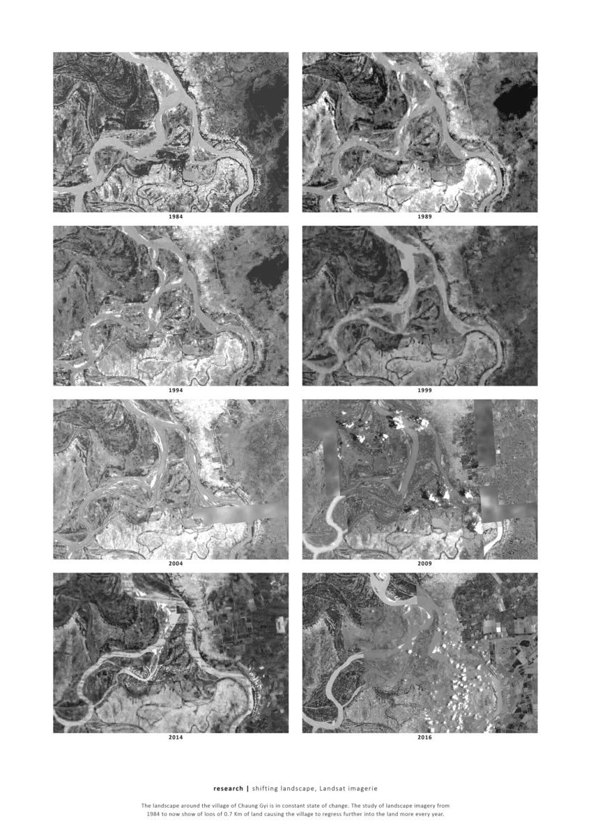
The shifting landscape of the village of Chaung Gyi, Myanmar. Raymonde Bieler (MArch 2), 2018.
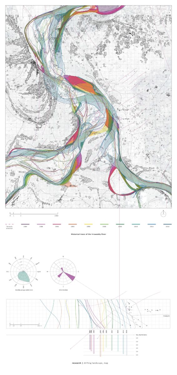
Historical trace of the Ayeyarwady River, Raymonde Bieler (MArch 2), 2018.
Marking shifting territory. Raymonde Bieler (MArch 2), 2018.
Marking shifting territory. Raymonde Bieler (MArch 2), 2018.
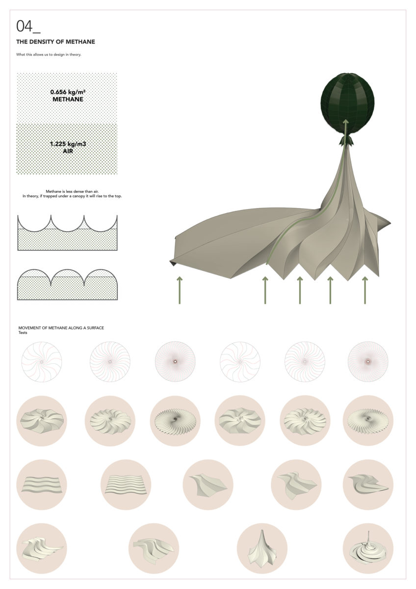
Katie Dechow (MArch 1) designed a canopy to capture and spatialise methane emissions from rice fields in Myanmar.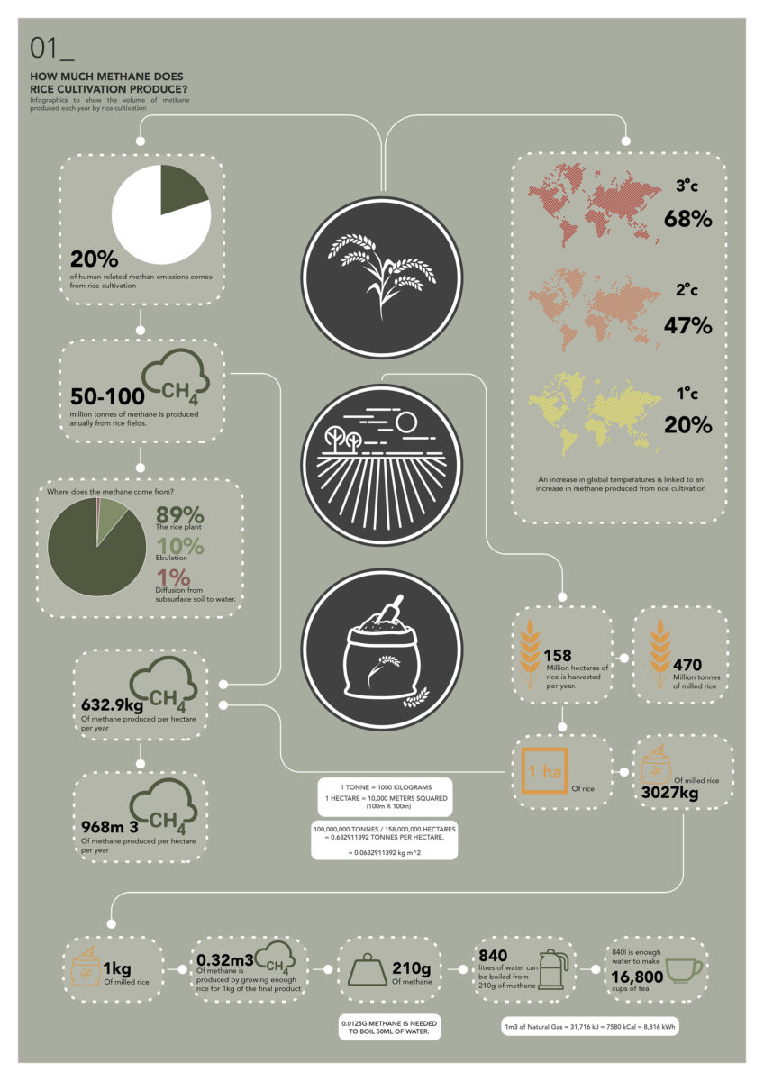
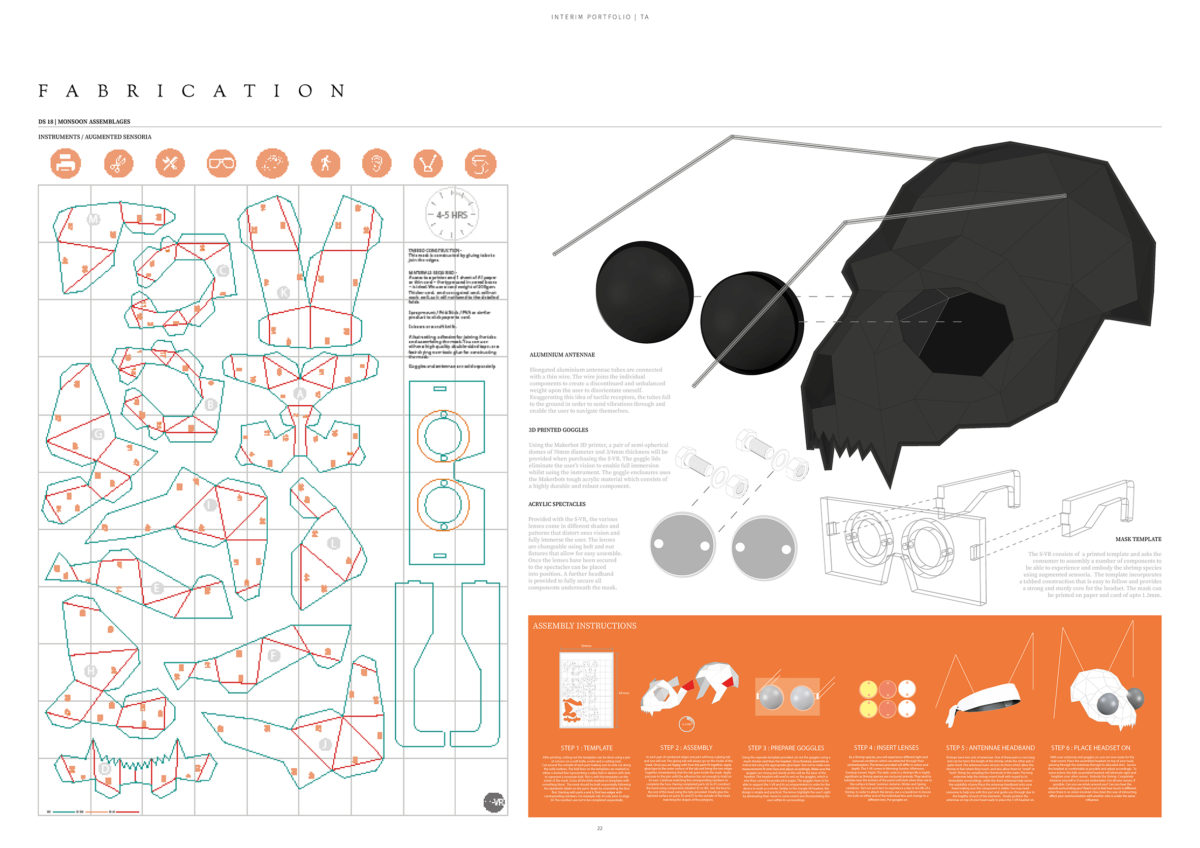
Because shrimps can neither see nor hear, Temanna Akhter (MArch 1) designed an instrument, in the form of a face mask, to enable humans to experience the sensorially deprived world of the shrimp.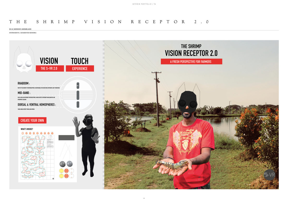
This is but a small sample of student responses to these briefs.